|
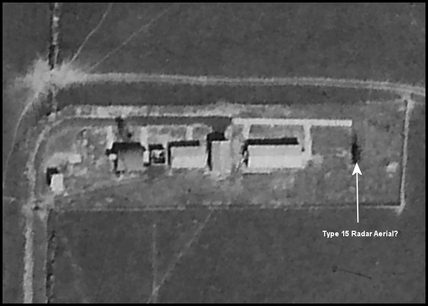
A
tiny area of a 1946 aerial photo covering the whole airfield, cropped and
rotated to show the radar site. The Type 15 aerial was a square rotating
mesh type, mounted on a moveable trolley. Unusually for today's practice
the cables linking the aerial to the transmitter and receiver fed the top
of the aerial and entered the building just under the roof line.
There is a bricked up square opening in the Ronaldsway building at just
the right location. Click images to toggle between the 1946 and annotated
2021 views.
|